What To See?
Nature, beautiful views, peace and quiet, untouched territories and biodiversity – explore the nature sites in Saldus municipality!
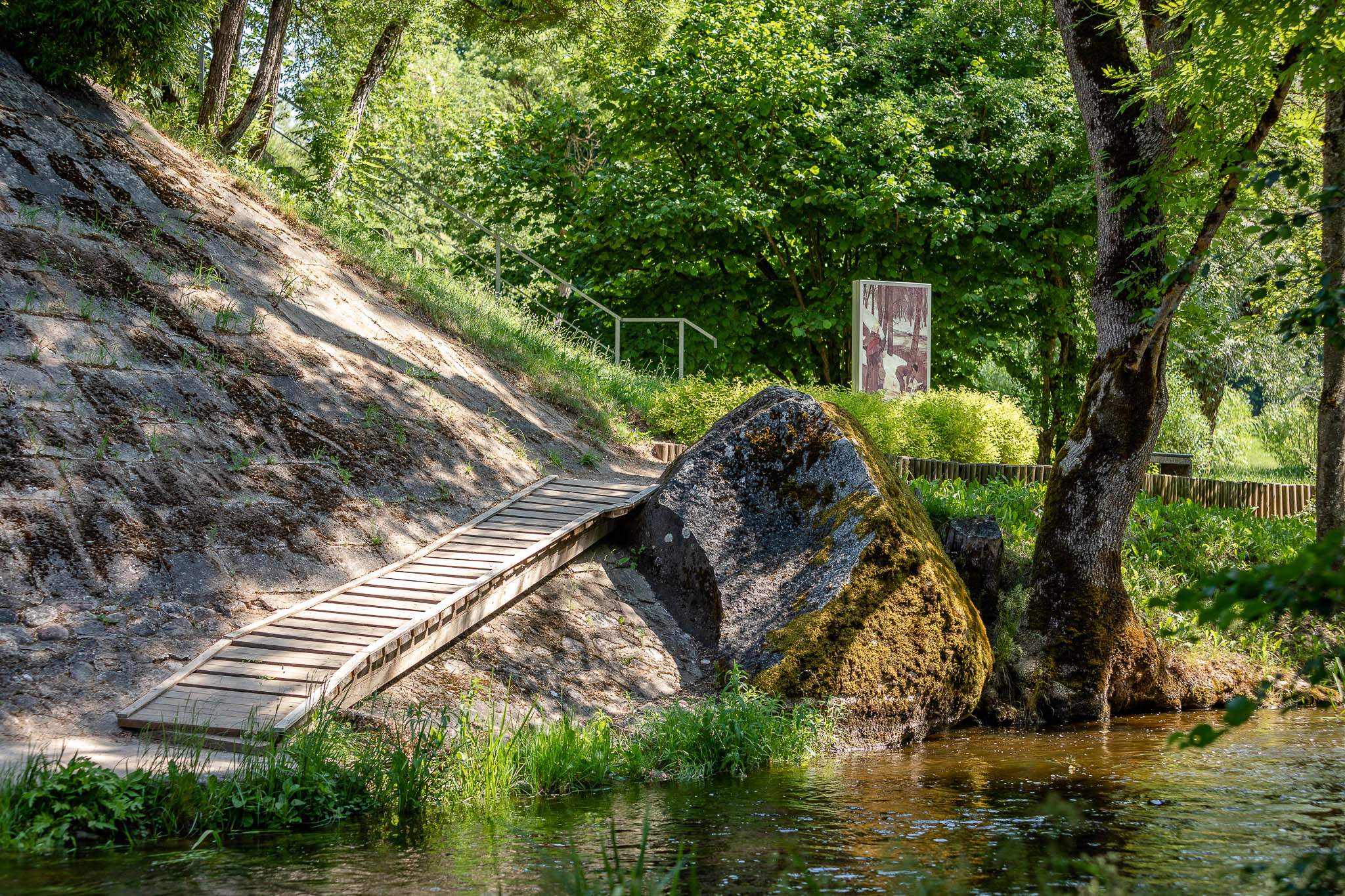
Walking Trails “Path of Art, Music and Love”
The “Path of Art, Music and Love” is an approximately 5km long route of connected walking trails in the Kalsētas Park. It was created to introduce the visitors to the history of the park and two great natives of Saldus – painter Janis Rozentāls and musician Ēriks Ķiģelis. Narrow paths and wider trails will lead you through the hills along the steep banks of the Ciecere river. There are several information boards at the most popular places in the park, displaying facts and stories about historical events and notable people. The information is also translated into English and Russian.

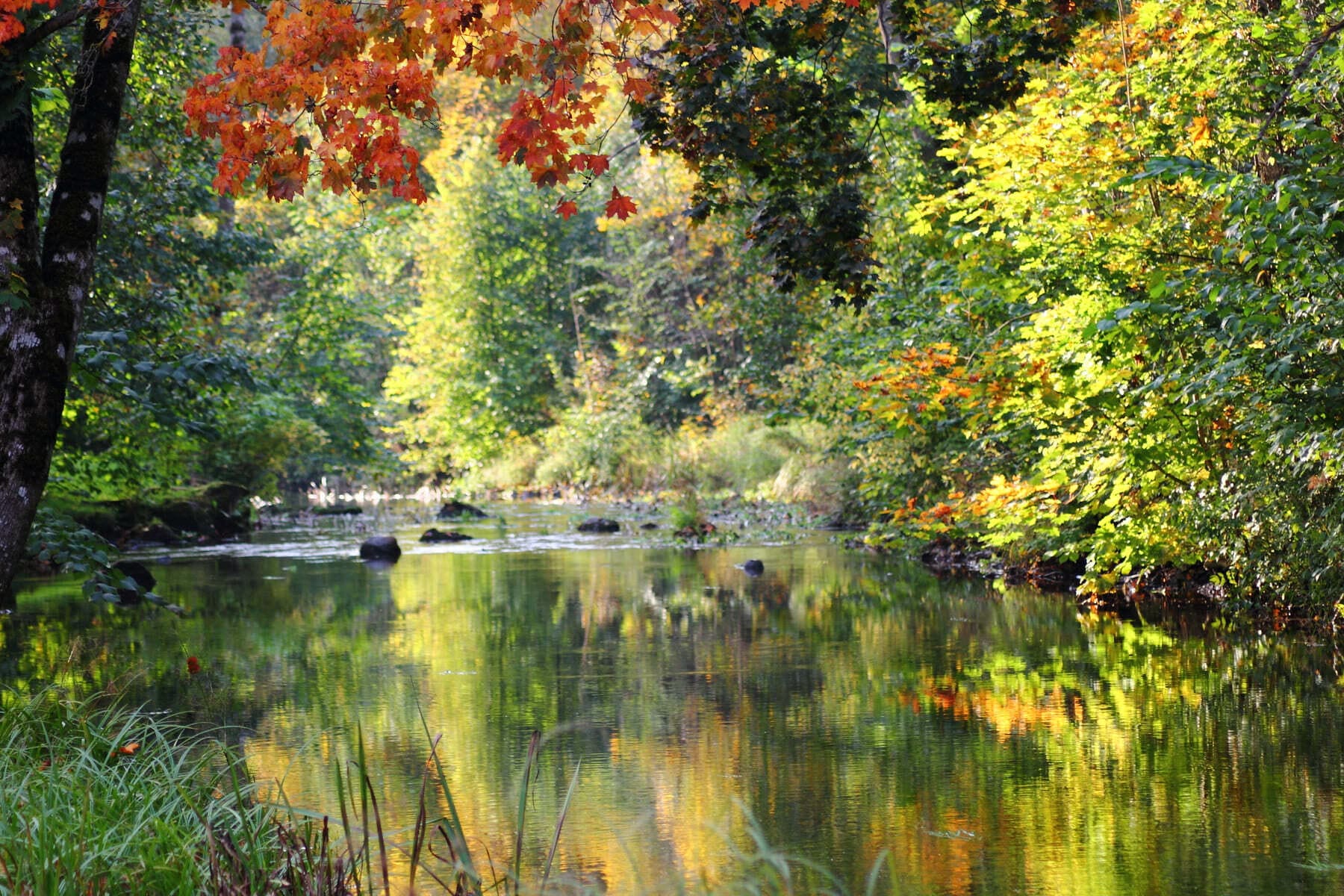
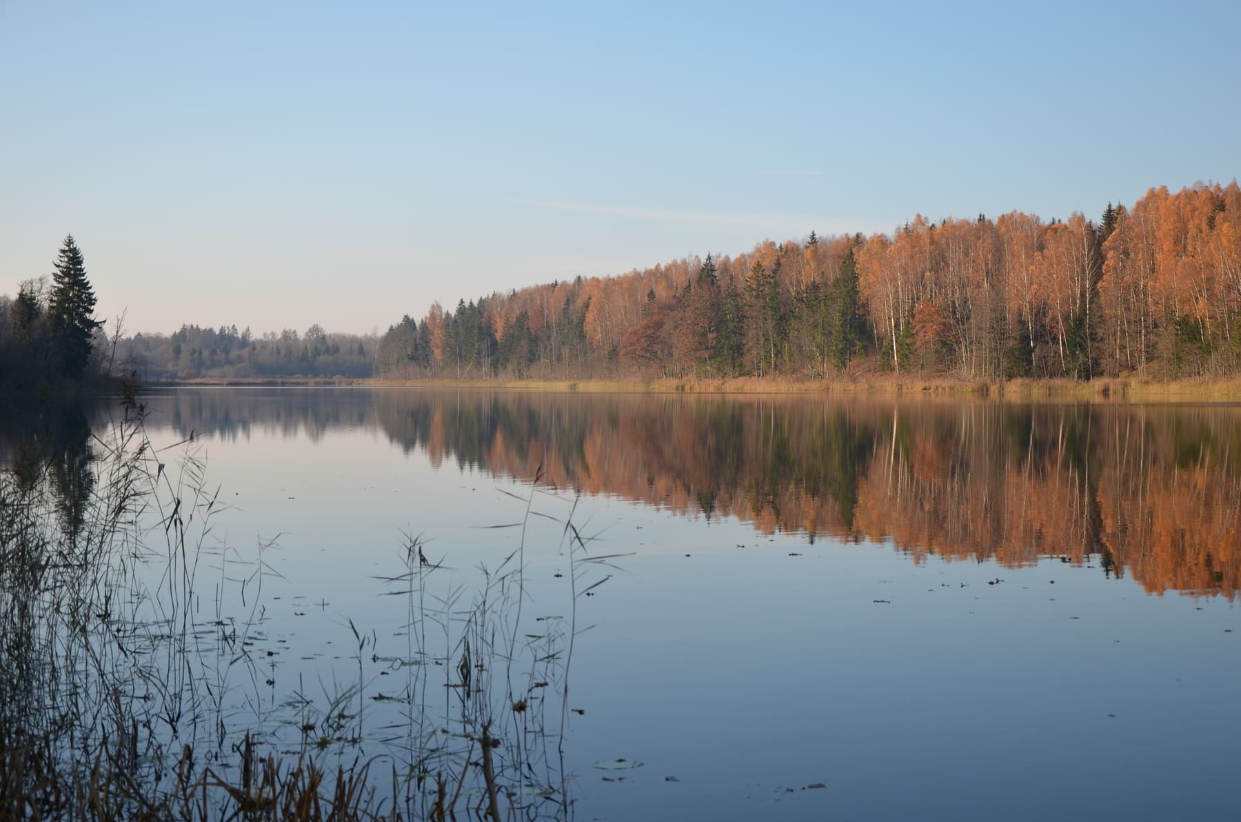
The Ciecere River
Ciecere is a 51 km long right-bank tributary of the Venta river. It flows out of Lake Ciecere and absorbs 52 tributaries during its course. The average width of the river is 10 m, it meanders and forms islands in some sections.
The Ciecere river meanders through Saldus town for 6 km creating a large green area in the town centre.
Today, looking at the river, it seems quite incredible that in the 17th century it was navigable. However, historical records show that during the reign of Duke Jacob, Ciecere was used to transport products from various factories around Saldus. At the end of the 19th century, the businessman Vicinskis even built a boat “Frauenburg” for pleasure trips on the Ciecere river – from the town centre to Upesmuiža.

Ciecere Nature Trail
The beautiful nature and walking trail meanders along the Ciecere River from the Kuldīgas Street Bridge to the Saules Street Bridge. On the other side of Kuldīgas Street the walkway continues and leads to the beach of the picturesque Saldus lake. Part of the trail was built as a plankway and is also suitable for visitors with prams. It passes the largest playground of the town. The trail is surronded by beautiful plants and gardens, and the area is especially pictuiresque and impressive during summer time.

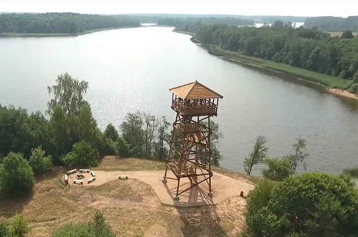
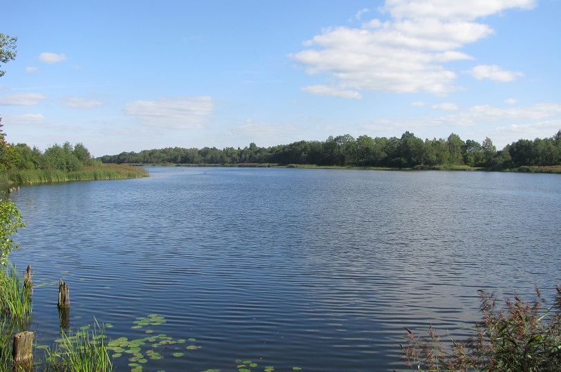
Lake Ciecere and Observation Tower
The 18.4 m tall observation tower is located next to Lake Ciecere, 6 km from Saldus and 6 km from Brocēni. It offers stunning views on the lake and the surrounding scenery. The tower is built on an artificial hill and the total height is 30 metres. There is a picnic area near the tower.
Lake Ciecere (277 hectares) is located in the territories of Brocēni town and Ciecere parish. It is a proglacial lake and is the most expressive example of this type of lake in Latvia. In some places the lake is reminiscent of a river. The is one large island in the lake – the Oak Island (14 hectares), which is a nature reserve. The largest inflow is the Mazupe river (16 km), and the Ciecere river (51 km long) flows out of it.
Nature Reserve “Sātiņi Ponds” and Bird Watching Tower
The territory of Sātiņi ponds nature reserve with its 30 artificial ponds is located approximately 8 km to the south-west of Saldus. The ponds attract many bird species during nesting and migration season: whooper swans, northern lapwings, common snipes, black storks, red-necked grebes and many others. A 9.8 m high bird watching tower is located near one of the ponds.
Part of the territory is managed by Sātiņi fishery.

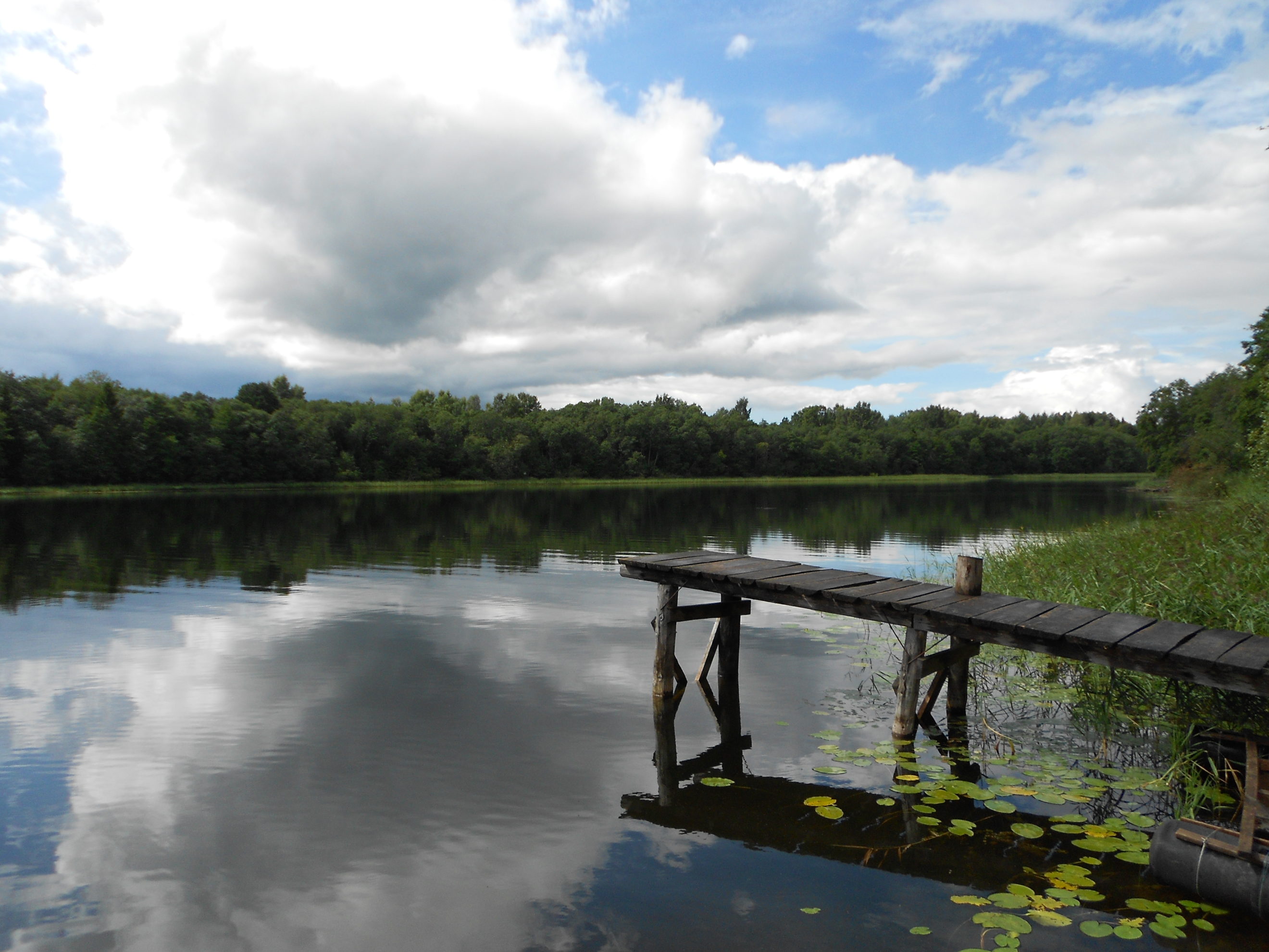
Walking Trail by Lake Ciecere in Brocēni
The walking trail starts at the public beach in Brocēni. It is approximately 1 km long, takes you along the shore of Lake Ciecere and ends behind the junction of Lielciecere and Krasta streets, not far from Brocēni forest park. There are several recreation sites by the trail.

Kalnsētas Park
The Kalnsētas Park is a popular place for recreation and entertainment. Along the banks of the Ciecere River and deeper into the park you will find both narrow, steep and romantic trails and wide paths for quiet walks, so everyone can find a suitable route to explore the park.
Kalnsētas landscape park was planted on the picturesque banks of the Ciecere River by Baron von Recke, the owner of Kalnamuiža (Berghof) manor at the end of the 19th century. Nowadays Saldus technical school is located in the Kalnamuiža manor house.
The Ciecere River, which was navigable in the 17th century, flows through the park. During the reign of Duke Jacob the river was used for transportation of goods from the production plants in Saldus area to other towns. Today, in the park area, Ciecere is shallow and rocky, and there is an artificially created waterfall.
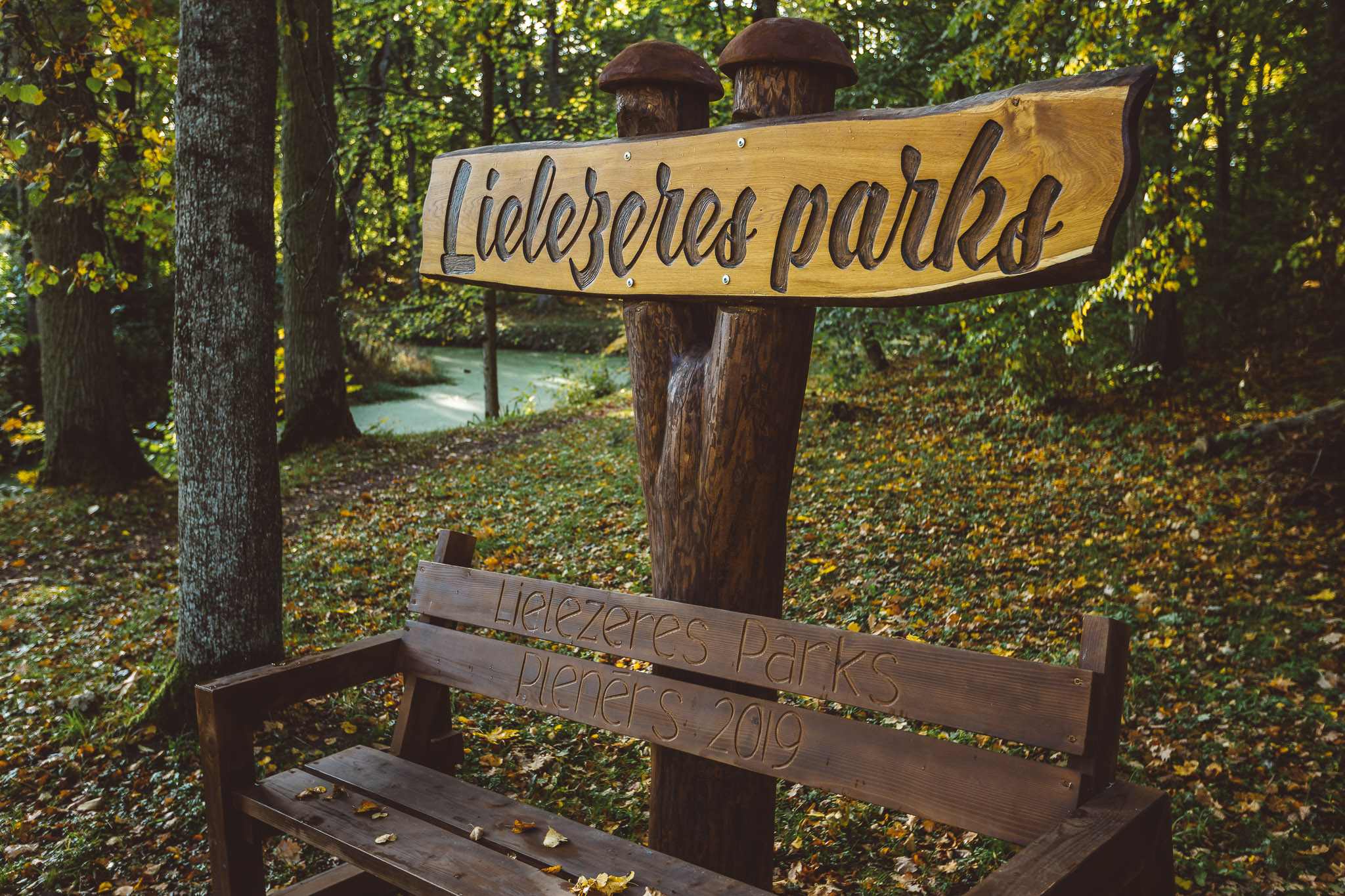
Ezere Nature and History Trail “In the Footsteps of Ancestors”
Beautiful scenery and historical places can be enjoyed in an entertaining and educational adventure along the Ezere nature and history trail “In the footsteps of ancestors” (“Pa sentēvu pēdām”). The trail starts near Ezere elementary school (Lielezere manor) and is 3 km long. It is also possible to visit the Customs house, where the capitulation act of Nazi German army units encircled in “Courland pocket” was signed on 8 May 1945.

Līkais Forest
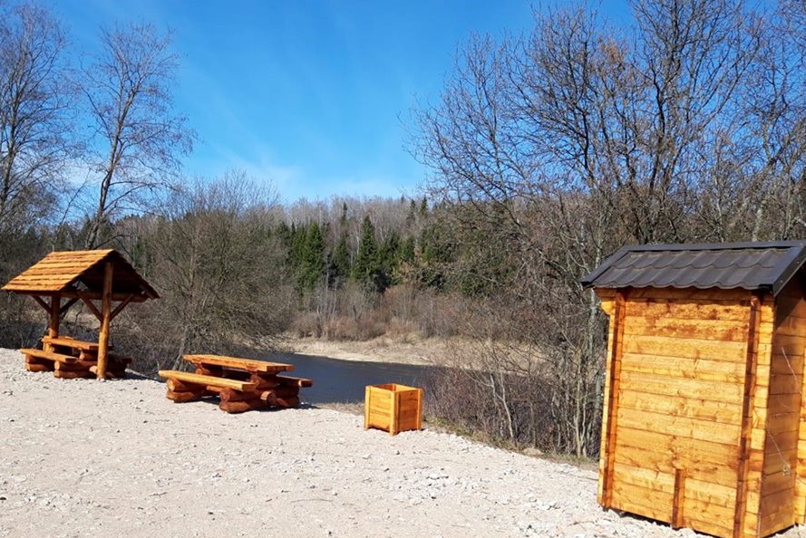
The Līkais Forest is located in Novadnieki parish and borders Saldus town. Several trails for running, walking and cross-country skiing have been created in the forest. Walkers should stay on the designated walking trails and not use the ski trails in winter. The trails start at the picnic area near Meža street.

Veides Forest
The Veides Forest is popular with locals for walking and sports activities. There are several trails in the forest, and everyone can choose individually, whether to take a shorter or a longer walk. The trails are not marked. There is a picnic area at the entrance into the forest, behind the stadium of Saldus Secondary School.

Saldus Hillfort
Saldus Hillfort, which is located near Lake Saldus, testifies to the ancient Curonian time in Saldus. The hillfort is a national archaeological monument. Many legends remain about Saldus Hillfort, most of them about the sweet life inside the hill. The Biļļu Hill scenic viewpoint has a parking area with a picnic table and provides the best views of the hillfort and the panorama of Saldus. Everyone is welcome to take a photo at the sign “Saldus”.

Brocēni Forest Park
The forest park is a great place to enjoy the forest and go for walks along the walking trails (approximately 3km long). There is a rhododendron garden in the forest – visitors can enjoy more than 60 blooming rhododendrons in early summer. Two ropes courses – “Brocēni Air Trails” – will let you enjoy the perfect outdoor adventure.

Striķi Manor Park
Striķi manor was built in the beginning of the 19th century. There are walking trails and also a playground in the park surrounding the manor. There is also a picnic area by the pond.

Striķi Hillfort
The Striķi Hillfort is a live history book. Here one can trace the footsteps of many centuries: the hillfort and burial sites of the ancient Semigallians, the cemetery of the Barons von Behr, trenches and bunkers from the war. There is an information stand at the hillfort. The distance from Striķi Manor to Striķi Hillfort is 2.6km.

Remte Manor Park
Remte manor is surrounded by a large (26 hectares) landscape park, planted at the beginning of the 19th century. The park features various trees and plant species, a pond and a system of canals. The “Hunting Tower” (restored in 2015), where the count had breakfast, the “Bear Hut”, where the bear cubs were kept, “Gazebo”, “Torture Chamber” and the man-made “Love Island” can still be seen in the park. The Love oak (circumference 5.3m), which is popular with newlyweds, grows here. Lake Remte (75.5 hectares) is located near the park.

Ezere Manor Park
The park between Ezere Manor and the Vadakste river occupies 24.1 hectares. It was created in the 19th century and features 36 foreign trees and shrubs. There are nice walking paths in the park. The grand rock “The Ruler Of Vadakste” (“Vadakstes valdnieks”) (4.2m) can be viewed here. It was rolled up from the Vadakste river by manor’s servants.
Vadakste Manor Park & Lilac Garden
Vadakste manor is surrounded by a picturesque park planted in the 18th-19th centuries and featuring trees and shrubs of rare species. A lilac garden has been created in the park in recent years. There are 37 different types of lilac in the garden, at the moment 62 lilac trees have been planted, and the number is growing every year.

Jaunauce Manor Park
The park is part of the Jaunauce manor complex. It surrounds the manor house and separates it from the farm buildings. The best locations to enjoy the view were on the terrace of the manor house, the island, both pavilions, on the bridges and also on the pathways near the curves. The park serves as a resting place, a tourist destination, and a beautiful and diverse educational tool for people interested in culture and nature.

Geomorphological Nature Reserve in Zaņa
Geological and geomorphological nature monument, one of the Natura 2000 territories. A total of 8 protected habitats of European Union significance have been identified in the territory, of which 4 are also specially protected in Latvia, and 16 specially protected species.
Ancient Valley of Venta
In Nīgrande parish, the Venta river attracts visitors with picturesque views and great places for recreation.
Nature Reserve “Zvārde” and Nature Park “Zvārde Forest”
The 3072 ha large territory of Zvārde restricted nature area is one of Natura 2000 sites. It is situated within the parishes of Zvārde, Blīdene and Jaunauce, and comprises several swamps and swamp forests, wet black alder forests, mixed forests and a mesotrophic lake. Zvārde restricted nature area is an important area for migratory birds.
Nature park “Zvārde Forest” (Zvārdes meži) is situated within the parishes of Zvārde, Jaunauce and Ruba. Covering 8173 ha, the territory has developed under the circumstances of restricted economic activity over the last half of century. During the Soviet times, part of the territory situated in Zvārde parish was used as military training ground by the Soviet army. Vast agricultural lands in the territory excluded from economic activities were mostly overgrown by woods. Due to the long-term absence of human influence, a specific complex of habitats comprising significant nature values was created.
Nature Reserve “The Valley of the Rivers Venta and Šķērvelis”
This nature reserve comprises the valley of the Venta river and its tributory Šķērvelis. It is situated in Pampāļi parish in Saldus municipality and in Skrunda and Nīkrāce parishes in Skrunda municipality. It was created to protect a special part of the valley, where several protected biotopes are located. The most significant are sandstone outcrops, slope and ravine forests, rapid flows of rivers and natural river sections.

Ezere Mill Pond and Suste Pond
Ezere mill pond was created on the Ezere river at the end of the 19th century and is the largest water reservoir in Ezere parish (13.1 hectares). Next to the pond is the water mill, which was built at the beginning of the 20th century, and the mill pond sluice, which was put into operation in 1982. This type of sluice in the shape of a maple leaf is very rare in Latvia.
The nearby Sustes pond (8.2 hectares) is popular with fishermen and also is a place for leisure activities. Only licenced fishing is allowed in both ponds. There are picnic areas with campfire sites by the ponds.

Lake Saldus
The picturesque Lake Saldus is situated at the foot of several hills and is close to town centre. The lake covers 11.9 hectares. It has a beach, a recreation area with a beach volleyball court and a playground. There are public toilets by the lake. In the summer, visitors can have a refreshing drink or a snack at the beach cafe.

Zaņa Mill Pond
Zaņa mill pond was created, when the mill was built around 1880. It covers 22.6 hectares and is approximately 3km long with an average depth of 2.4m. There is an artificial island in the middle of the pond. Only licenced fishing is allowed here. 10 planks for fishing have been set up at the pond, there is a swimming area, a playground and a beach volleyball court.

Kanavišķi Water Reservoir
The water reservoir (19 hectares) was created on the Losis river. It is the largest water reservoir in Nīgrande parish. Brown coal deposits and outcrops have been found nearby, on the left bank of the Losis river. The former brown coal mining place can still be seen at “Līči”.

Vadakste Water Reservoir
Vadakste water reservoir (110 hectares) was created on the Vadakste river. It has become a popular place for recreation and fishing.
Lake Odzēni, Lake Svētaiņi and Lake Ķerkliņi
Lake Odzēni (20 hectares), Lake Svētaiņi (30 hectares) and Lake Ķerkliņi (50 hectares) are the biggest lakes in Zvārde parish. They are surrounded by forests and economically untouched territories – a landscape with long-term absence of human influence, which offers good possibilities for quiet recreation, fishing and bird watching.
Pakuļi Water Resevoir
Pakuļi water reservoir (172.4 hectares) was created on the Ciecere river, close to Lašupe. It is a popular place for recreation. Only licenced fishing is permitted in Pakuļi water reservoir. Licences can be purchased at Saldus Tourist information centre or online: https://www.manacope.lv/waterbody/pakulu_udenskratuve.

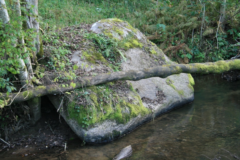
Rozentāls’ Stone
The picturesque Ciecere river has inspired many artists of Saldus, but only Janis Rozentāls has his own stone on the banks of the Ciecere. The artist often sat on the stone and painted. The stone is pictured in his paintings “By the stream” and “Winter landscape”.
Grand Rock “The Ruler of Vadakste” (“Vadakstes Valdnieks”)
Grand rock “The ruler of Vadakste” (4.2m) is located in the park near Ezere manor. This rock was rolled up from the Vadakste river to its present location by manor’s servants. The name of the estate manager von Toll and the numbers “1845-1855” are carved on the rock and might indicate the time it took to roll the rock from the banks of the Vadakste river, or the period when the park was created.

Lētīža Grand Rock
Lētīža grand rock lies on the right bank of the Lētīža river. Partially in water, it measures over 4m long and over 3m wide. The rock can be accessed from “Viļņi” homestead in Embūte parish. The owners will show the visitors the beautiful surroundings of their homestead.
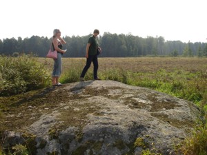
Cērpene Grand Rock
Not much is known about the Cērpene grand rock. Its dimentions are impressive – 7.1 x 4 x 1.5 metres.
Meldzere Hollow Rock
The Meldzere hollow rock is located on the right bank of the Lētīža river, approximately 9.5km from Nīgrande and 1.3km from Meldzere cemetery. The Meldzere hollow rock is an ancient cult rock. Local people have passed on the information about its meaning from generation to generation till the 20th century. It has been moved away from its original location. Locals did it to prevent the rock from being destroyed.

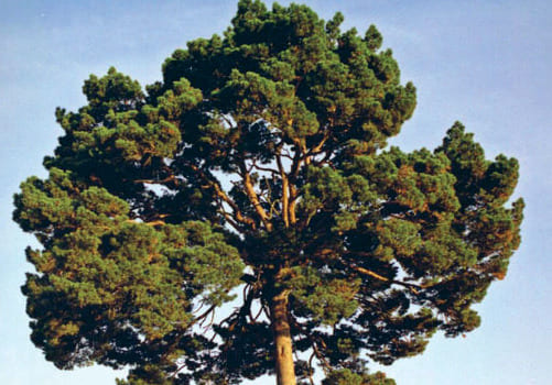
Palm Pine-Tree
This unique pine-tree is the only one in Latvia that has gained the shape of a palm-tree. It grows in Kursīši parish, near Baloži homestead. The tree is 13m tall and has a globe-shaped crown with a diameter of 10m.
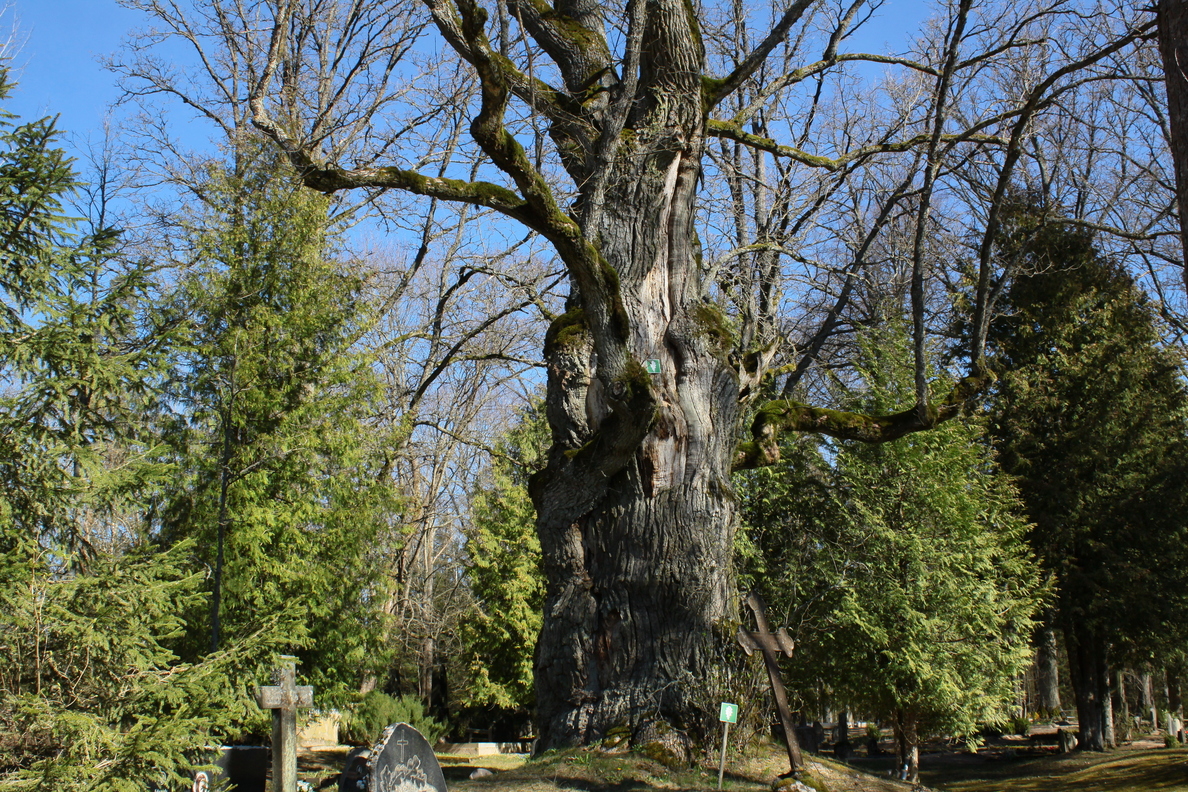
Kalnziednieki Grand Oak
Kalnziednieki oak-tree can be found not far from the roadand the centre of ošenieki village. With a circumference of 7.9 metres, it is the largest oak-tree in Saldus municipality.

Sauļu Oak-Tree
This oak-tree grows in Sauļu cemetery in Kursīši parish. With its circumference of 6.52 this grand oak really stands out in the typical Latvian rural cemetery.
Līči Grand Oak
Līči grand oak (circumference 6.16m) is located on the steep bank of the Ciecere river.

Bruņinieku Oak-Tree
Bruņinieku oak-tree is located near the road Lutriņi-Lašupe. The impressive tree is fastened with wires because of a crack. The tree can be easily seen when driving from Lutriņi to Lašupe.
